
Mapping
What Is an MSA? Metropolitan Statistical Areas, Census Tracts and Your Community Reinvestment Act (CRA) Assessment Area
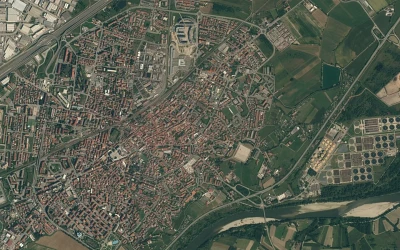
Every HMDA and Community Reinvestment Act (CRA) record you file depends on a piece of geography most filers never look at directly: the Metropolitan Statistical Area. The MSA decides which median income a census tract is measured against, which boundaries your CRA assessment area has to respect, and whether a property needs geography fields on the HMDA register at all. Below: what an MSA is, how it fits with counties and census tracts, and what shifts in your data when OMB redraws one. Key takeaways An MSA is a group of whole counties that the Office of Management and Budget (OMB) delineates around an urban core of 50,000 or more people. It is not a city limit. Census tracts sit inside counties, and counties make up MSAs, so every tract carries one state code, one county code and at…
- 2025 Community Reinvestment Act (CRA) Small Business, Small Farm and Community Development Lending Data: What Changed and What to Do Next
- The CFPB's Semiannual Report: What Narrower Federal Enforcement Means for Fair Lending, HMDA and Community Reinvestment Act (CRA) Programs
- How to Choose Section 1071 Software: What to Test Before Your First Filing
- The Regulation B Lawsuits: What Your Fair Lending Program Should Keep Doing While the Rule Is in Court
- California's New Fair Lending Exam Law: What State-Chartered Banks, Credit Unions and Mortgage Licensees Should Have Ready
- November 2026
- October 2026
- September 2026
- August 2026
- March 2026
- February 2026
- January 2026
- 2025
- 2022
- 2021
- 2020
- 2017
- HMDA vs CRA vs Section 1071: What Each Rule Collects and Who Has to File
- 2026 HMDA Data: Your Filing Checklist for the March 1, 2027 Deadline
- HMDA Plus: What It Actually Changed in the LAR Workflow
- Fair Lending Regression Analysis: What It Controls For and How to Explain a Pricing Disparity
- How to Evaluate Fair Lending and CRA Software: What to Test Before You Sign
- What a Fair Lending Exam Actually Asks For
- What Actually Counts as a Small Business Loan Under Section 1071
- Section 1071 in 2026: What Lenders Need to Know About Small Business Lending Data
- How to Benchmark Your CRA and HMDA Lending Against Peer Data
- Special Report: Geocoding - Achieving the Highest Accuracy

